From Satellite to Soil.Every Hectare Matters.
AI-powered precision agriculture platform for modern farmers. Cut waste, boost yield.
200,000+ ha
Fields Monitored
10,000+
Users
1M+
Queries & Views
Sectors
Every stakeholder in agriculture has different needs. AGRO4-Field technologies deliver tailored solutions for every sector — from seed to contract production, from finance to machinery makers.
Farmers
Monitor your field from space, track crop health, and cut input costs with variable-rate fertilization. From monitoring to application, precision farming from a single hand.
AGRO4-Field · AGRO4-VRALearn More →Seed Producers
Monitor the development of seed plots from satellite; report variety trials, emergence uniformity and yield potential with objective data.
AGRO4-InsightsLearn More →Contract Farming
Supply-chain tracking for companies running contract production: monitor hundreds of growers' fields from one panel, forecast harvest, and audit compliance.
AGRO4-InsightsLearn More →Forage Producers
Cutting-time optimization for alfalfa, silage maize and pasture management; harvest at peak nutritional value with dry-matter and biomass estimation.
AGRO4-InsightsLearn More →Banks & Insurance
Objective field scoring for credit and agricultural insurance decisions. Manage your portfolio with data using satellite history, yield forecasts and risk analysis.
AGRO4-Insights · ScoringLearn More →OEM & Machinery Makers
AGRO4-VRA integration for agricultural machinery manufacturers. Add variable-rate fertilization capability to your own spreaders and fertilizer machines at the factory.
AGRO4-VRA · IntegrationLearn More →Public & Local Government
Regional-scale farmland monitoring, drought and harvest tracking, subsidy auditing and agricultural planning. For municipalities, agriculture directorates, irrigation unions and development agencies.
AGRO4-InsightsLearn More →Designed for the Field,
Built for the Future
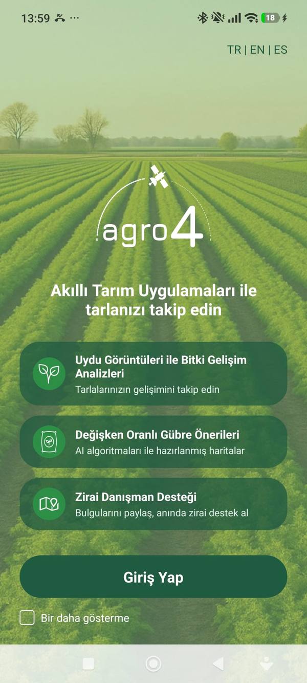
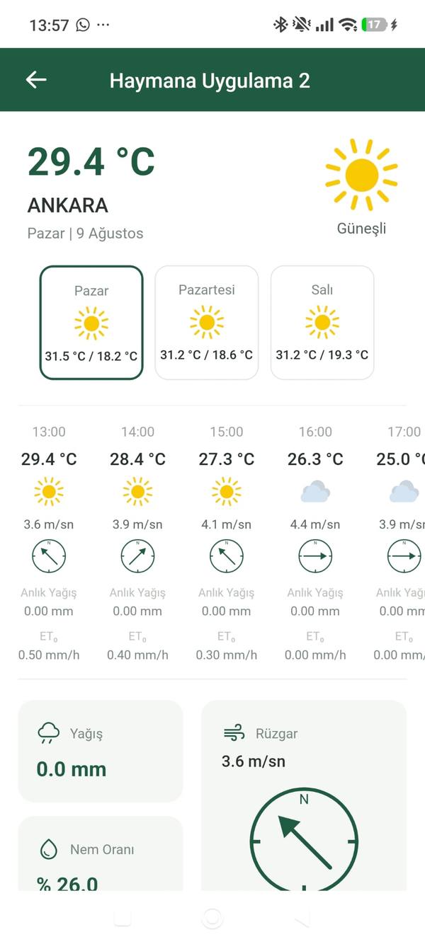
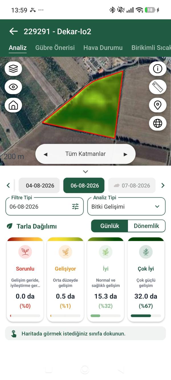
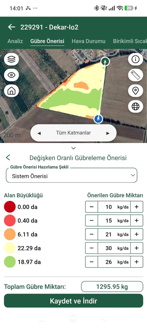
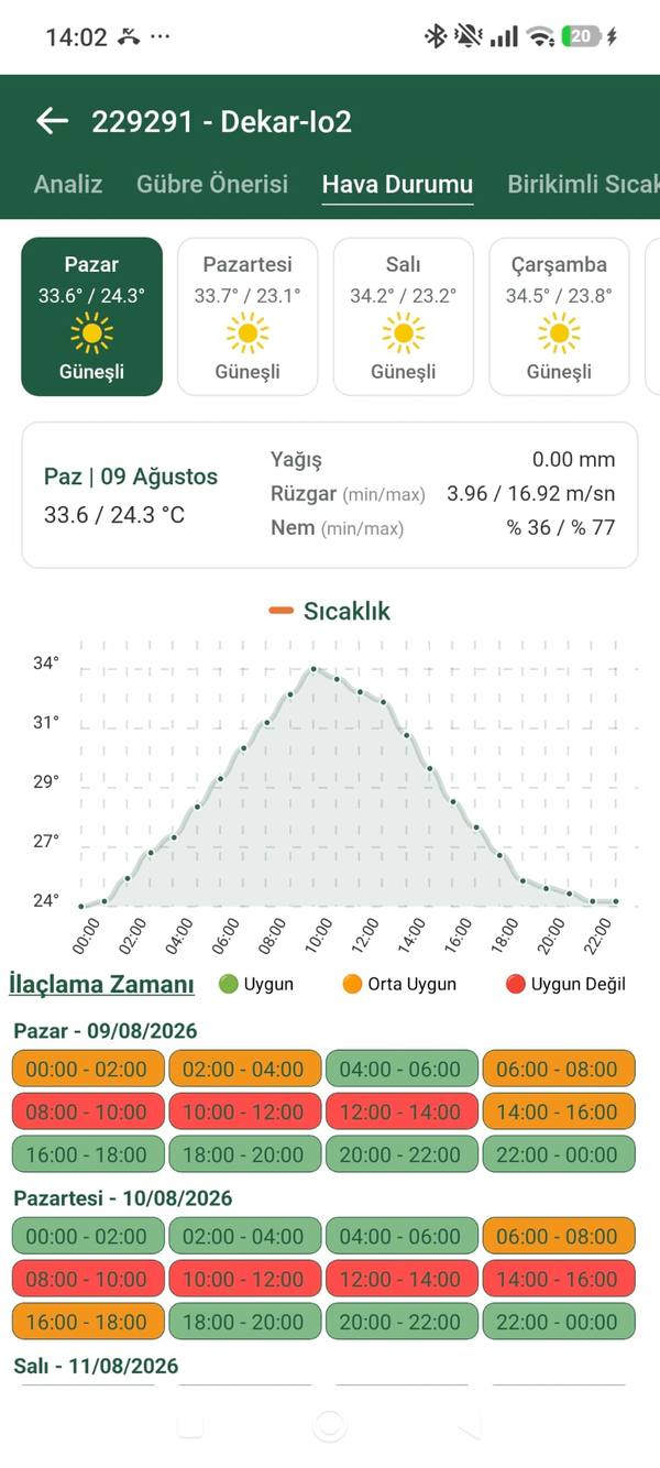
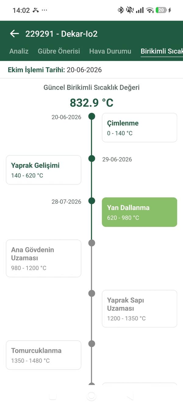
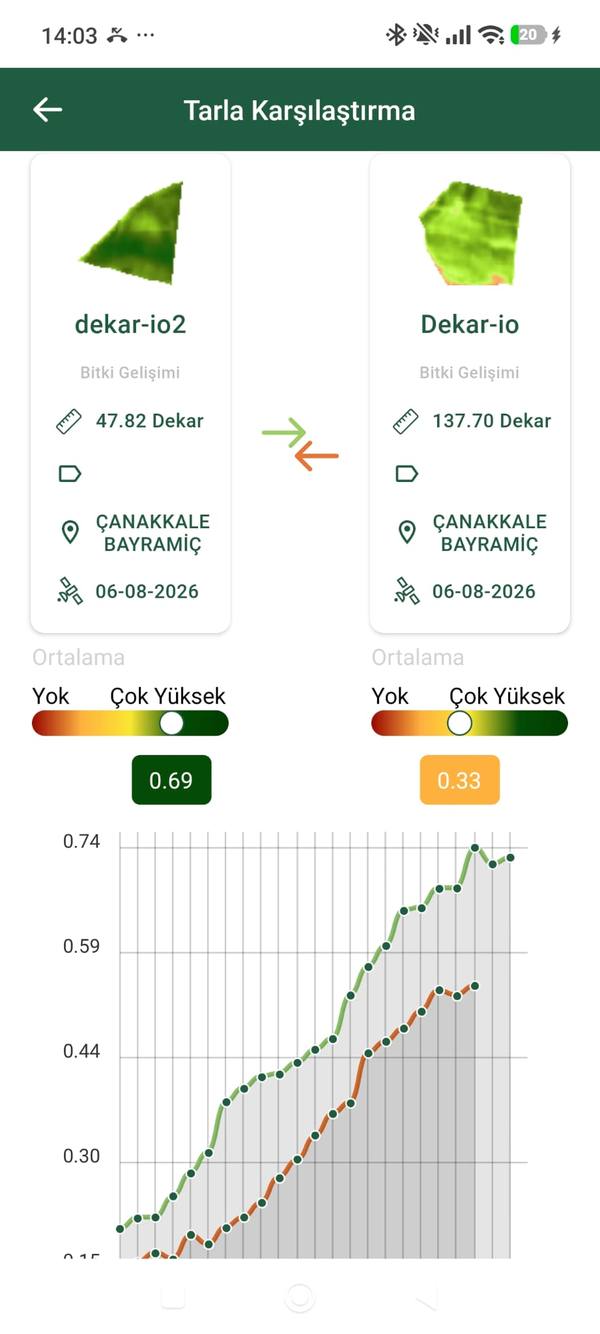
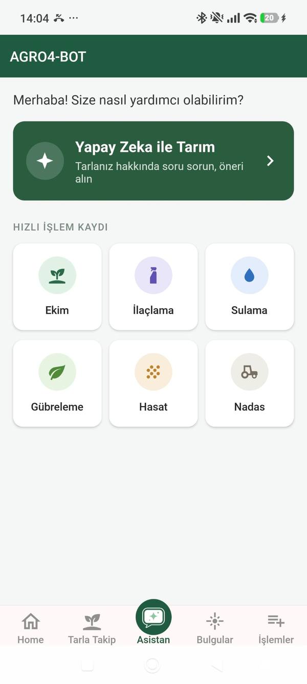
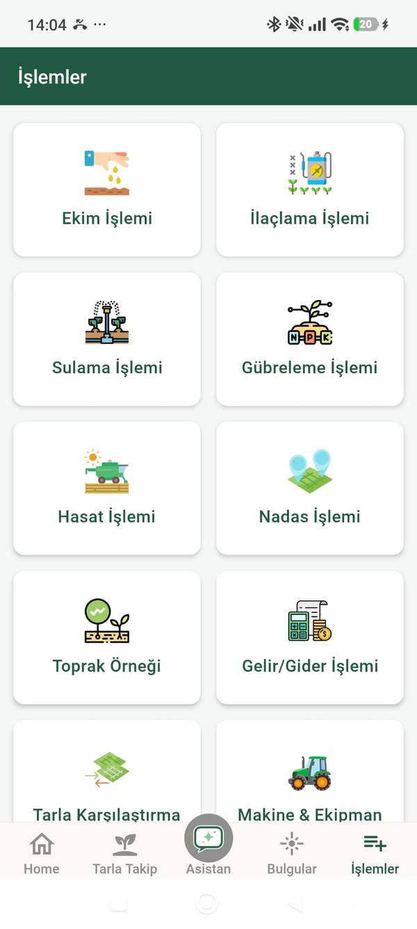
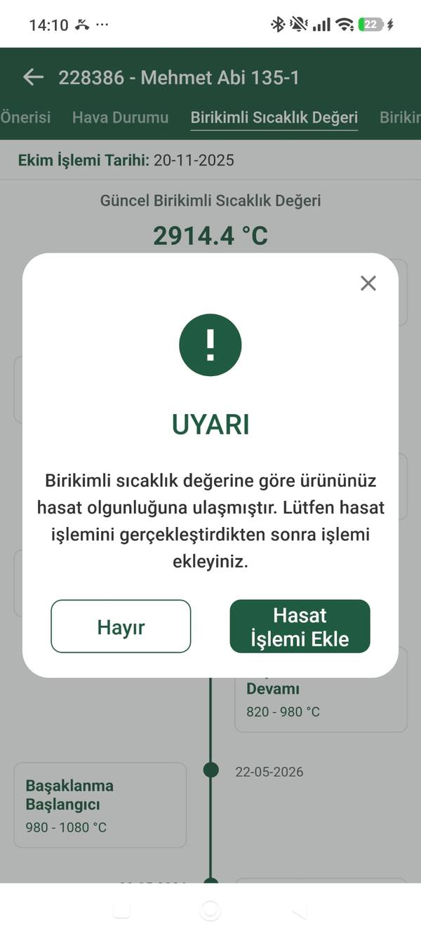
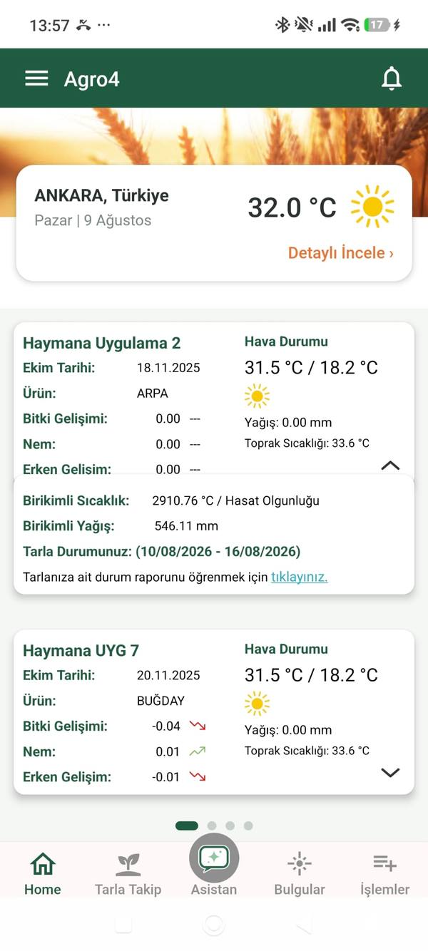
Field Monitoring in Your Pocket
Access real-time satellite imagery, growth maps and automated anomaly alerts from anywhere. Built for agronomists and farm managers who need data in the field.
- ✓Real-time satellite imagery
- ✓Vegetation, moisture, chlorophyll, nitrogen status and more indices
- ✓Phenology-driven crop growth tracking (GDD)
- ✓Automated anomaly detection and instant notifications
- ✓Multi-field portfolio management
- ✓Available on iOS, Android and Web
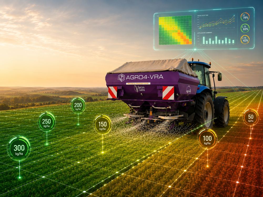 🚜 Machine-integrated — variable-rate fertilization in action
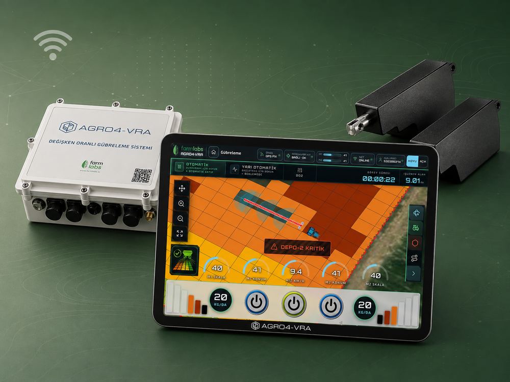 🔧 AGRO4-VRA KIT — automatic fertilization control screen
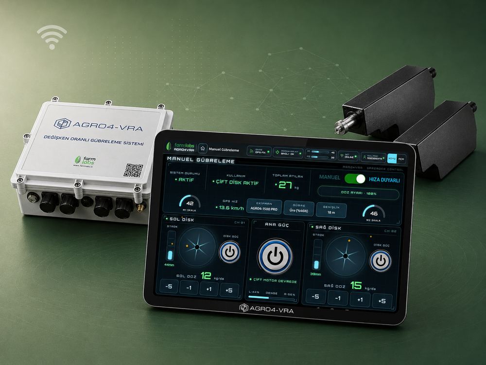 🎛️ AGRO4-VRA KIT — manual & speed-sensitive control
Variable Rate Fertilization System
Reads AI-based zone maps from satellite data live and automatically adjusts fertilizer dose zone by zone. Offered in two forms: a KIT that mounts on your existing machine, or a fully Integrated system.
- ✓Up to 25% fertilizer savings
- ✓Variable-rate fertilization based on crop growth status
- ✓Speed-sensitive application
- ✓Automatic section control by field boundary
- ✓Wireless communication with the spreader
- ✓Calibration by fertilizer type
- ✓Automatic mapping by working width
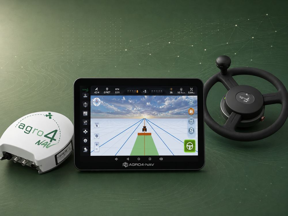
Autonomous Steering System
An RTK-GPS auto-steering system that locks the tractor onto field lines with centimeter precision for flawless track-following without a driver — up to 15% average fuel savings.
- ✓±2.5 cm line accuracy (RTK FIX)
- ✓Straight, curved and circular line support
- ✓Zero overlap · real-time track logging
- ✓Compatible mounting for existing tractors
- ✓Uninterrupted day/night operation
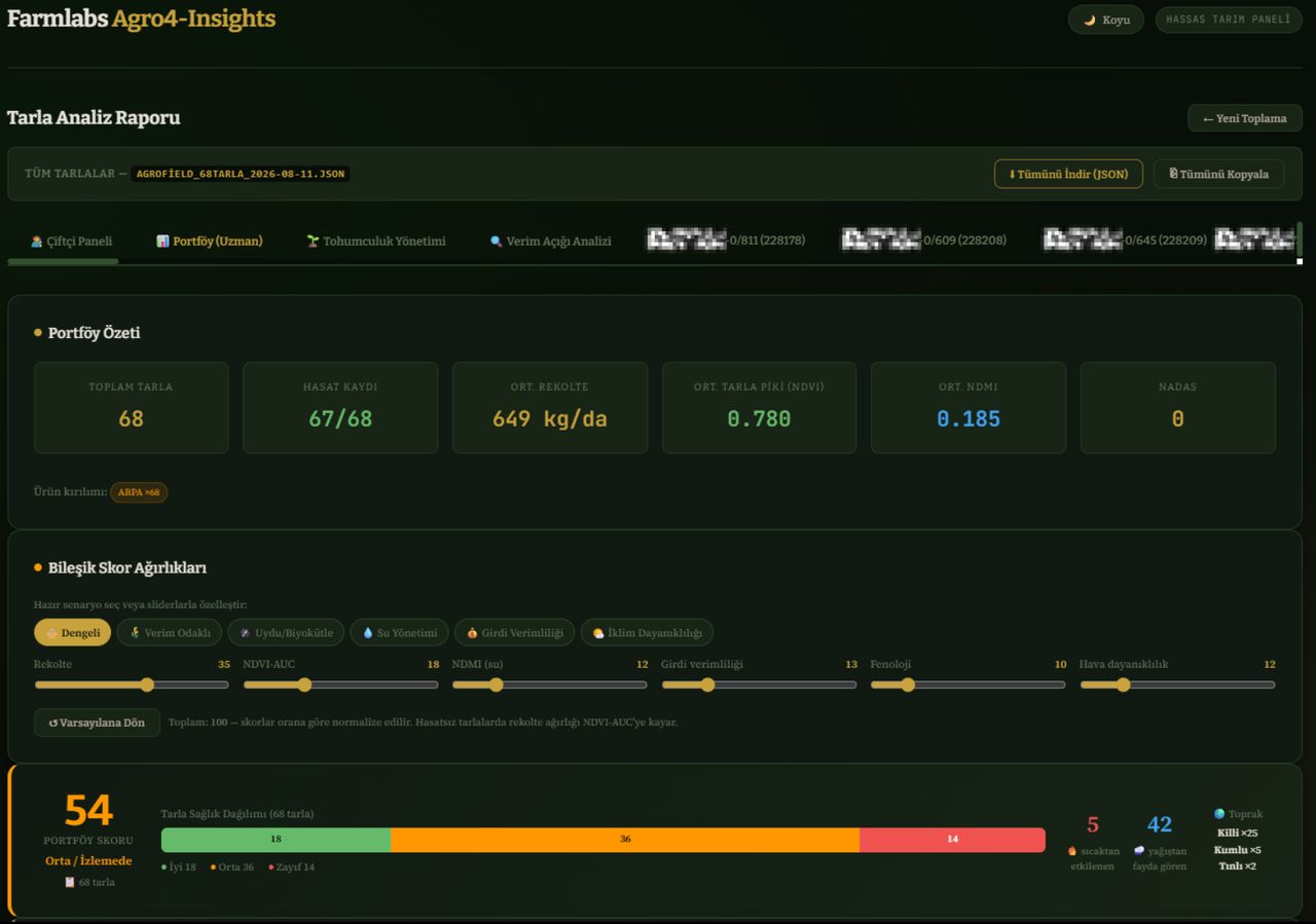 📊 Farmer Panel — portfolio summary & composite score weights
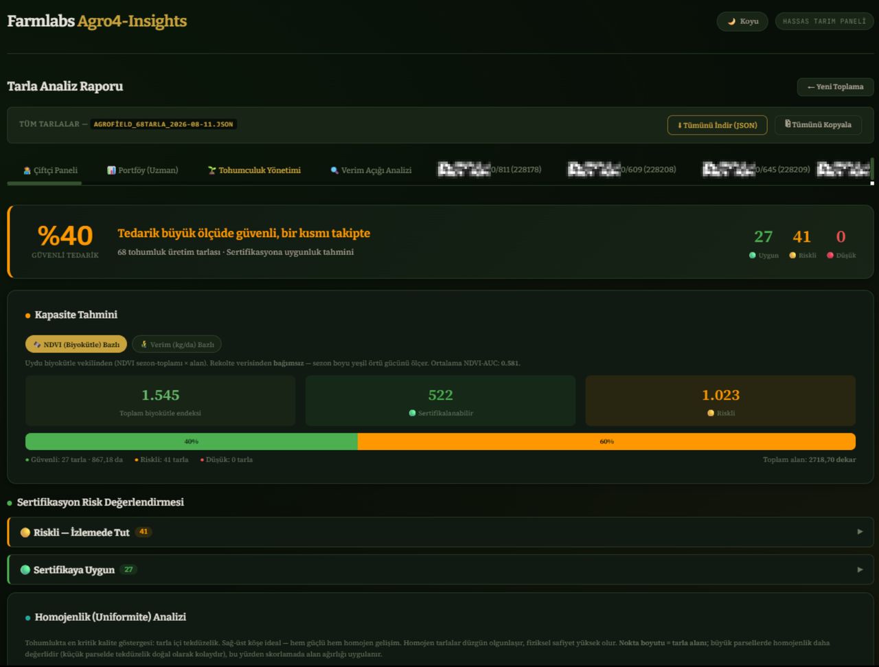 🌾 Seed Management — secure supply & capacity forecast
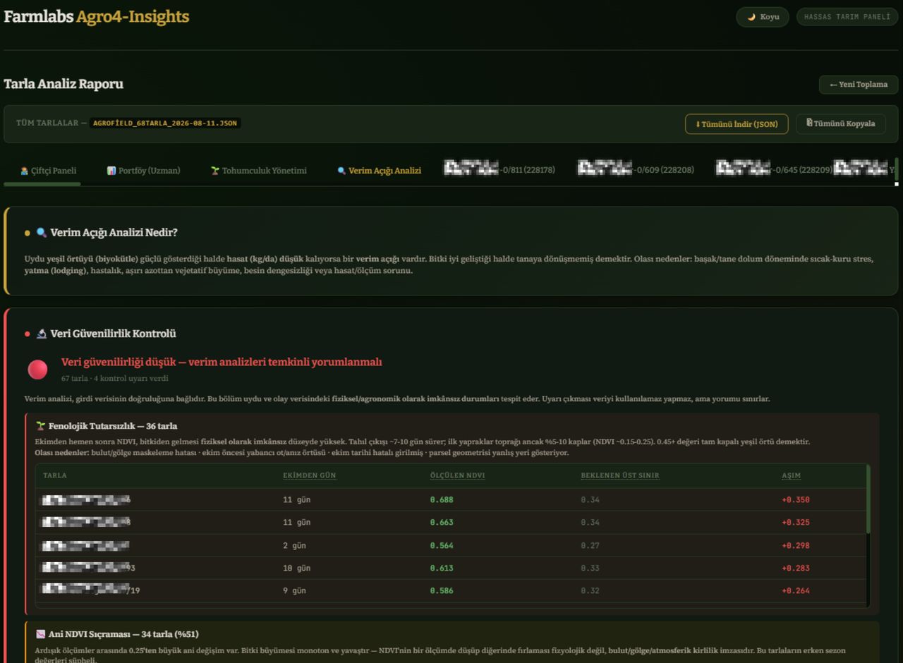 🔍 Yield Gap Analysis — data reliability check
Data & Scoring Platform
An analytics and scoring engine that unifies satellite, weather and agronomic data on one platform. Empowers the decisions of different sectors — from seed producers to banks — with objective data.
- ✓Parcel-based growth and yield scores
- ✓Multi-grower / portfolio panel
- ✓Risk scoring for banks & insurance
- ✓Sector-specific reporting and export
- ✓Integration via API
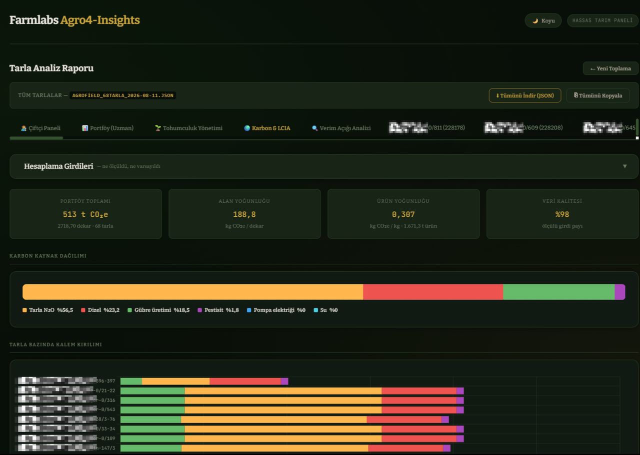 🌍 Carbon & LCIA — portfolio carbon summary & source breakdown
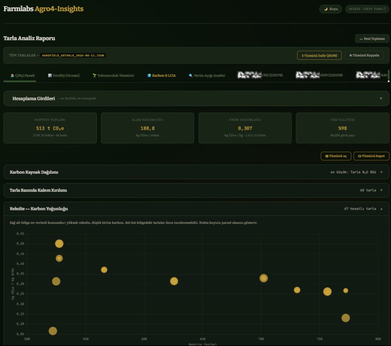 📊 Yield ↔ carbon intensity analysis
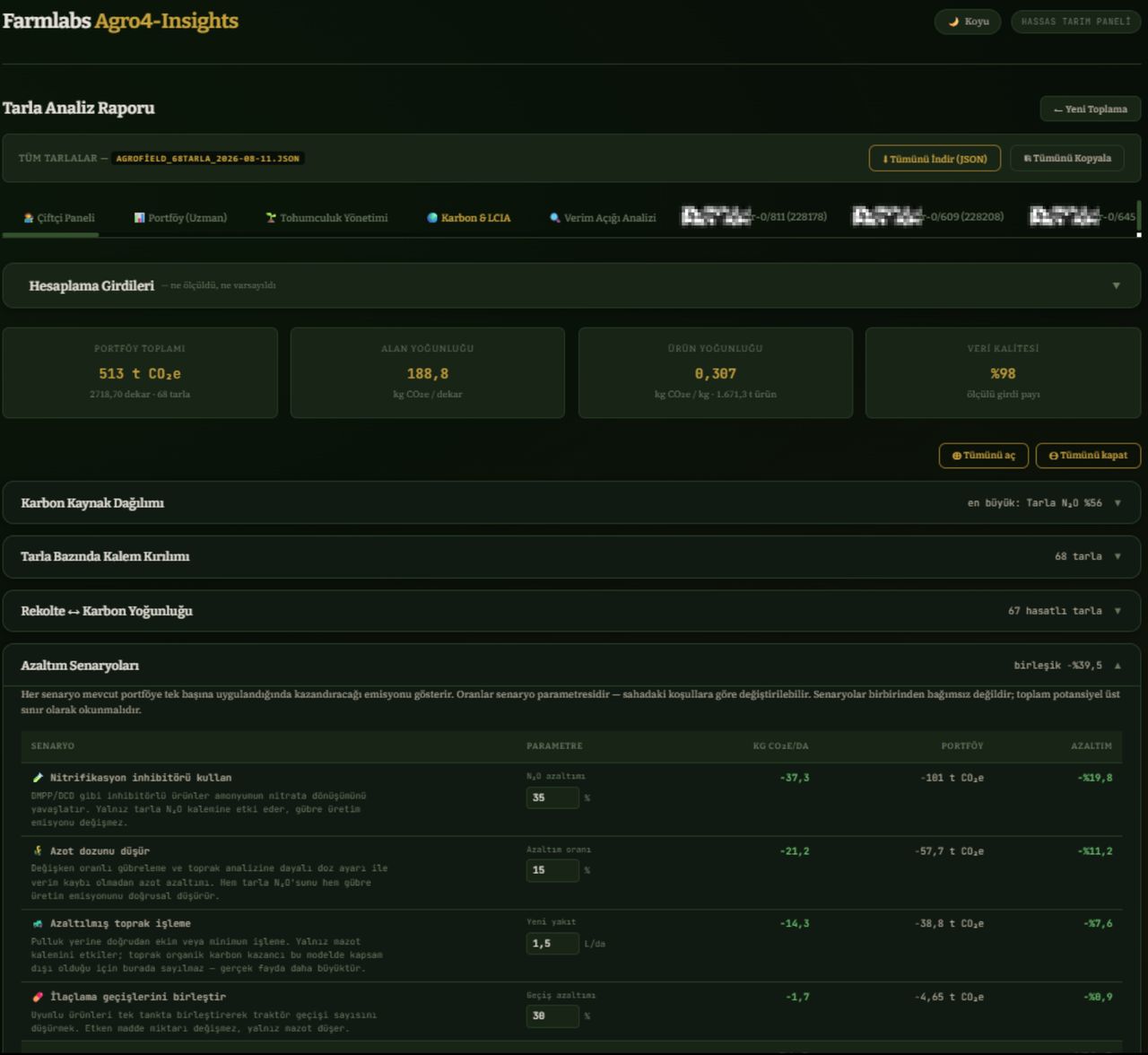 ♻️ Reduction scenarios & emission potential
Carbon & Sustainability Platform
Unifies satellite and field data with carbon accounting, product life-cycle impact and SDG-based sustainability reporting on one platform. Measure, reduce and document agriculture's environmental footprint with verifiable reports.
- ✓Carbon accounting & credit (MRV)
- ✓Life-cycle impact assessment (LCIA/LCA)
- ✓SDG-based sustainability score
- ✓Supply chain (Scope 3) emission visibility
- ✓ESG & corporate reporting outputs
By the Numbers
Impact at Scale
0+
Area Monitored
hectares
0.00t
Fertilizer Saved
in 2025
0+
Users
and growing
0+
Years of R&D
INNOVATE UK · EIT · HORIZON 2020 · TAGEM · TÜBİTAK
Organizations That Trust Us
We work together with Türkiye's leading agricultural organizations, public institutions and research institutes.













Ready to Transform
Your Farm?
Join thousands of farmers already using FarmLabs technology to grow smarter, waste less, and profit more.